Rainy Sunday, chance for snow Tuesday
This weekend is going to be a 50/50 weekend! A beautiful Saturday awaits us, but most of Sunday will feature rain showers.
First, we’ve got a couple spotty snow showers out there this afternoon and evening that may coat the grass in spots. Overall, we’re not expecting much accumulation. Saturday morning will be cold! We’ll wake up to the 20s and 30s.

The rest of your Saturday will be nice and bright! Highs will be a tad bit chilly, overall in the low 40s.
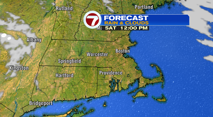
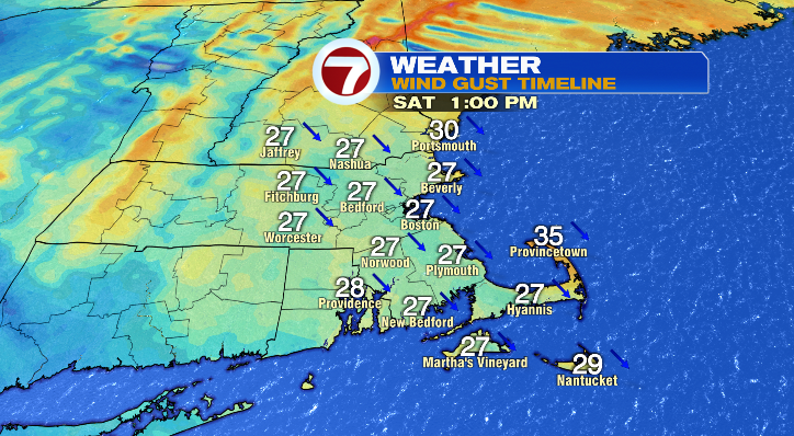
However, there will be a bit of a breeze at times, and that will make it feel closer to the freezing mark in the afternoon, so make sure to bundle up!
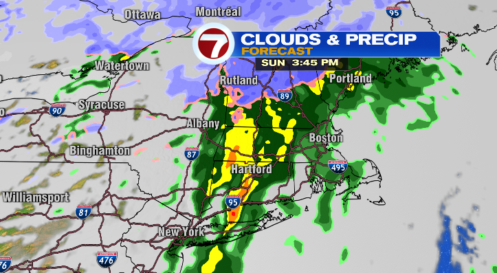
Sunday morning we’ll be waking up to the 30s with mild highs in the upper 40s later in the day. Skies will be cloudy right away, and rain will push in during the afternoon. It may briefly start as snow in higher elevation areas, but generally this will be plain rain. The rain will exit from the west to the east Sunday night late.
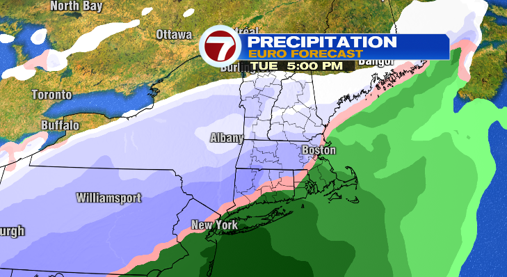
Monday is looking quiet! Lows will drop to the 30s with highs in the low 40s. Skies will feature a sun/cloud mix and it’ll be a bit breezy again making it feel chilly! We’re watching our next potential for some snow on Tuesday. There will be a rain/snow line that sets up across our area, but it’s too early to say exactly where, and that will dictate snowfall totals. There’s a good chance of plowable snow, but we have a while to wait on this! We’ll be watching it closely for you as the week progresses.
Lows Tuesday will be in the 20s and highs differ greatly: low 40s across the southeast and low to mid 30s farther north and west of Boston. Wednesday and Thursday: dry and in the 20s to the upper 30s. Friday: cloudy and a cold start in the teens! Highs will reach the low 30s.
Stay tuned!
from Boston News, Weather, Sports | WHDH 7News https://ift.tt/73wCdeE
via IFTTT