Long stretch of warm, dry weather ahead
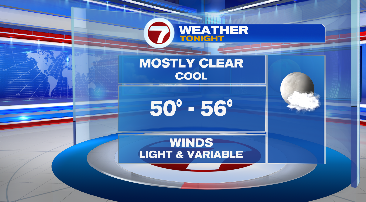
While plenty of us stayed dry for the second half of the weekend, many locations did pick up on some random pop-up showers. Overnight, though, we no longer have that chance as skies clear and temperatures drop.
Overnight lows will reach the low to mid 50s which is cooler than average for this time of year.
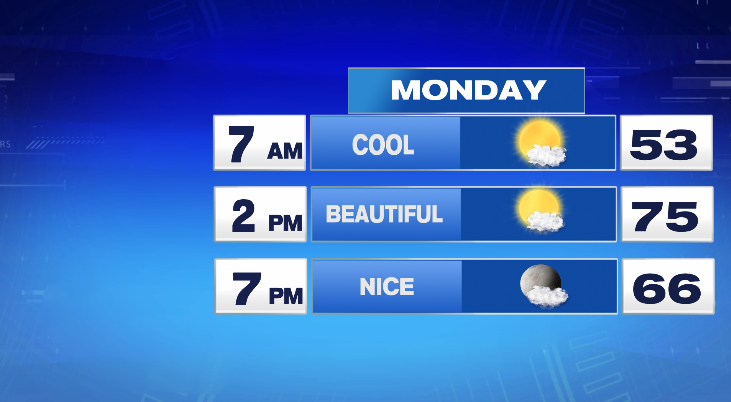
Monday will be a 10 out of 10 weather day! While the morning will be cool, afternoon highs will reach the mid 70s. Humidity will be comfortable in central Massachusetts, and it may feel just slightly sticky along the coast. Overall, a great day with plenty of sun.
Tuesday and Wednesday will both be incredibly similar days. Highs will top off in the mid to upper 70s after morning lows in the 50s. Skies will be sunny.
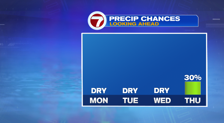
Our next chance for rain doesn’t come until Thursday. This is still days away so we’ll have to wait a few days to see exactly how this pans out. However, right now it seems a system in the area could create a few pop-up showers.
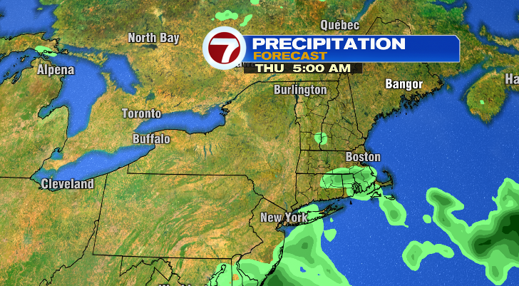
Otherwise, it’ll be partly sunny Thursday and warm still in the upper 70s. Friday will be the warmest day this week! High temperatures are expected to reach the upper 70s and low 80s with bright skies. However, a big cooldown comes after. Saturday will only reach the upper 60s in the afternoon, and Saturday night into Sunday temperatures will dive way down into the 40s.
Stay tuned!
from Boston News, Weather, Sports | WHDH 7News https://ift.tt/YrWk3GD
via IFTTT