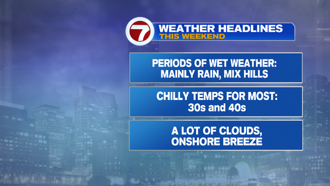
Cool, cloudy and damp weekend
This weekend will look and feel a lot different than today. Clouds will dominate with periods of wet weather. Temperatures stay chilly with a raw feel.
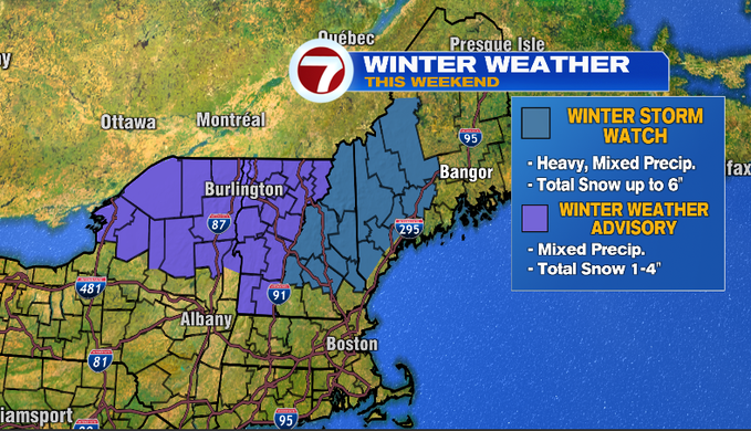
This will primarily be a rain event for us in southern New England. There will be some mixing for the Hills. Snow will accumulate for northern New England. That’s where travel could be slick and difficult at times.
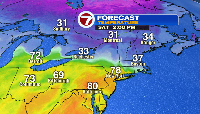
The warmth was felt from the Midwest to the Mid Atlantic today. The warmer air will work toward Southern New England, but meet colder air coming down from Canada and Northern New England. A stalled front will hang out across New England and divide the chilly and warm air. We’ll be on the chilly side of things with temperatures generally in the 30s and 40s. Check out what’s going on just to south! Temperatures will be summer-like in the 70s near 80.

Not only will we stay chilly, but moisture will move in along the front. It won’t be raining the entire weekend. You’ll still be able to find dry time. There’s a better window for that on Sunday. More rain favors towns to the north compared to the south.
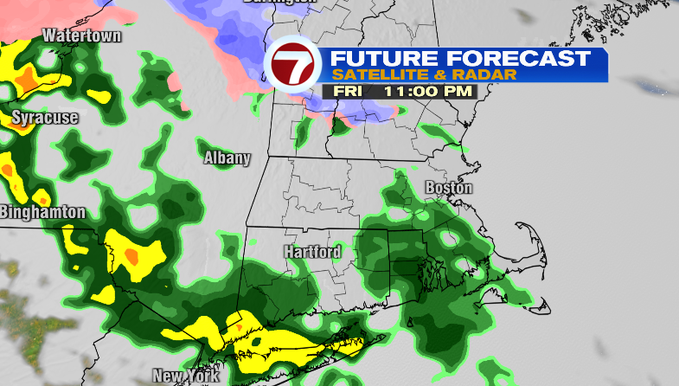
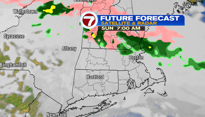
Here’s what radar could look like through the weekend. Scattered showers fill in tonight and linger through about sunrise. Some showers are still possible through the morning. You might find a lull in activity for the early afternoon. Then another wave of precipitation comes in through the late afternoon/evening. Temperatures will be in the 30s so ice is possible for the Hills. We continue with that overnight into Sunday. Showers linger in the morning. There could be some drizzle at times through the day. Another wave of rain moves in later in the evening/night.
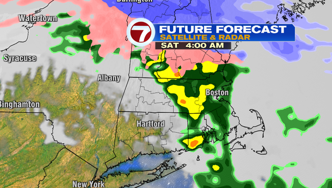

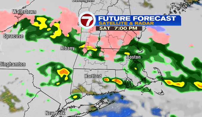
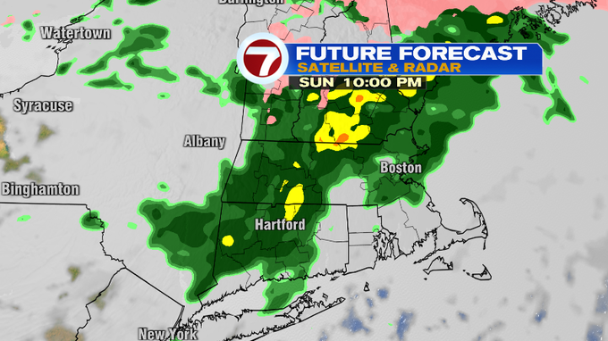
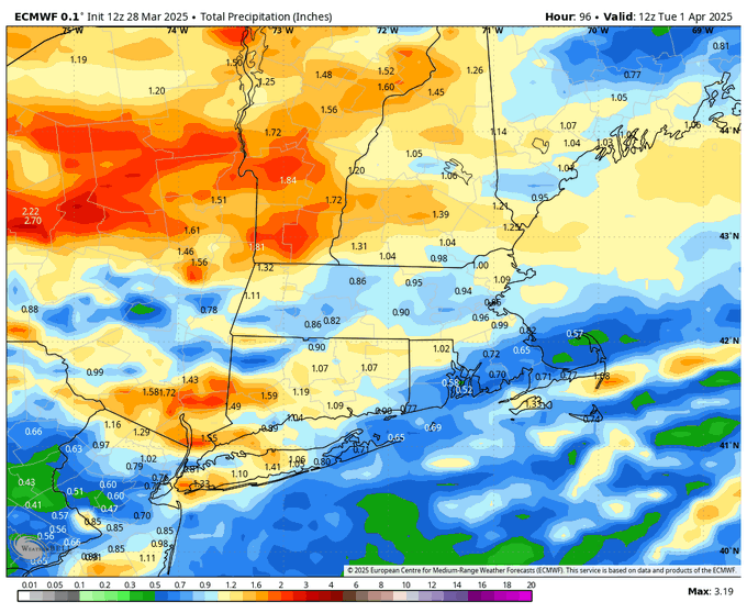
Rainfall through Sunday night will generally be .25″ to up to 3/4″. We’ll add to those rain totals with a wetter day on Monday.

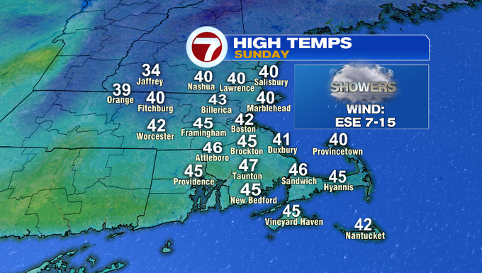
Saturday’s temperatures will start out in the 40s and then fall through the day down into the 30s. With a northeast breeze and the damp conditions, it’ll be a raw feel and likely feel chillier for you than the actual air temperatures.
Sunday morning we start off in the mid/upper 30s. Then we reach the 40s.

Monday brings morning showers followed by night rain. We’ll clear out Tuesday morning and get the sunshine back! Wednesday will be dry. Showers return Thursday. Temperatures could soar into the upper 60s, possibly touch 70 (we’ll see!) next Friday.
-Meteorologist Melanie Black
from Boston News, Weather, Sports | WHDH 7News https://ift.tt/DGSnILW
via IFTTT
